VeldScan: Advanced Terrain Analysis for Explorers
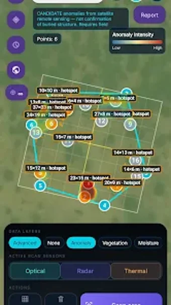
VeldScan is a powerful mobile application designed for Android users, specializing in travel and navigation. It enables field teams and explorers to analyze satellite-derived map layers effectively, identifying terrain anomalies that warrant on-site verification. Key features include the ability to draw scan areas on satellite maps, review anomaly intensity heatmaps, and switch between various data layers such as Anomaly, Vegetation, and Moisture. Users can also utilize Optical, Radar, and Thermal scan sensors for comprehensive analysis.
The app offers a grid mode for structured field checks, allowing for systematic examination of areas of interest. Additionally, users can access ranked analytical reports highlighting top candidates for verification and can easily export or share results in PDF format. It is important to note that VeldScan provides candidate signals from remote sensing, and findings should always be verified in the field.